Dolomites Hiking: Easy Trails & Cable Car Routes for Stunning Views
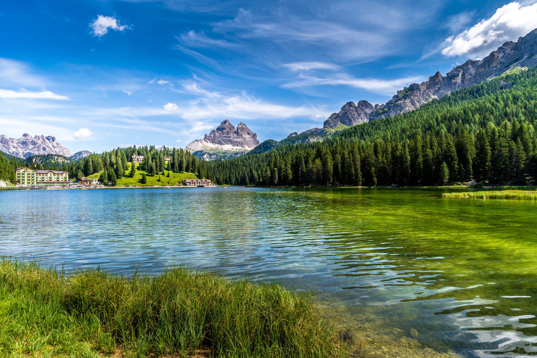
My first glimpse of the Dolomites wasn't from a challenging summit, but from a gentle cable car ride ascending towards Seceda, where I discovered the secret to experiencing these peaks without the grueling climbs. This guide reveals not just the best easy trails and cable car routes, but also my personal tips for beating the crowds, finding unexpected viewpoints like Cadini di Misurina, and staying connected with tested eSIM speeds, ensuring your trip is unforgettable and stress-free. This guide focuses on exactly that: incredible Dolomites hiking without the need for technical skills, often with a little help from a cable car.
The Dolomites for Everyone: Understanding the Landscape
The Dolomites are unique. Their distinctive pale rock, called dolomia, glows pink at sunrise and sunset, a phenomenon known as enrosadira. Crucially for hikers, the region has an extensive network of well-maintained trails, many of which are easily reachable thanks to a fantastic system of cable cars and chairlifts. These lifts whisk you up thousands of feet in minutes, bypassing the steepest climbs and depositing you directly into high-alpine meadows and panoramic ridgelines. Add to this the beloved rifugio (mountain hut) system, and you have all the ingredients for a truly unforgettable, yet approachable, hiking adventure.
Navigating the Dolomites Hiking Season
When to Go (and When Not To)
Timing is everything for Dolomites hiking. The main season typically runs from mid-June to late September, though this can vary. Here’s a breakdown:
- May and Early June: Still very much shoulder season. Many higher trails will have snow, lifts might not be fully operational, and rifugios will be closed. Mud is a common companion. Avoid if you're set on high-altitude walks.
- Late June to Early September: Peak season. All lifts and rifugios are open. The weather is generally warm and stable, but afternoon thunderstorms are common. Expect crowds, especially on popular routes and at iconic spots like Lago di Braies and Tre Cime. Booking accommodation and rifugio stays well in advance is essential.
- Late September to Mid-October: My personal favourite. The larch trees turn a brilliant golden, the air is crisp, and the crowds begin to thin significantly. Many rifugios start to close by mid-October, and some lifts may reduce their hours or close entirely. Check opening times meticulously for your chosen routes. The weather can be unpredictable, with early snow possible at higher elevations.
The Rifugio System: Your Mountain Oasis
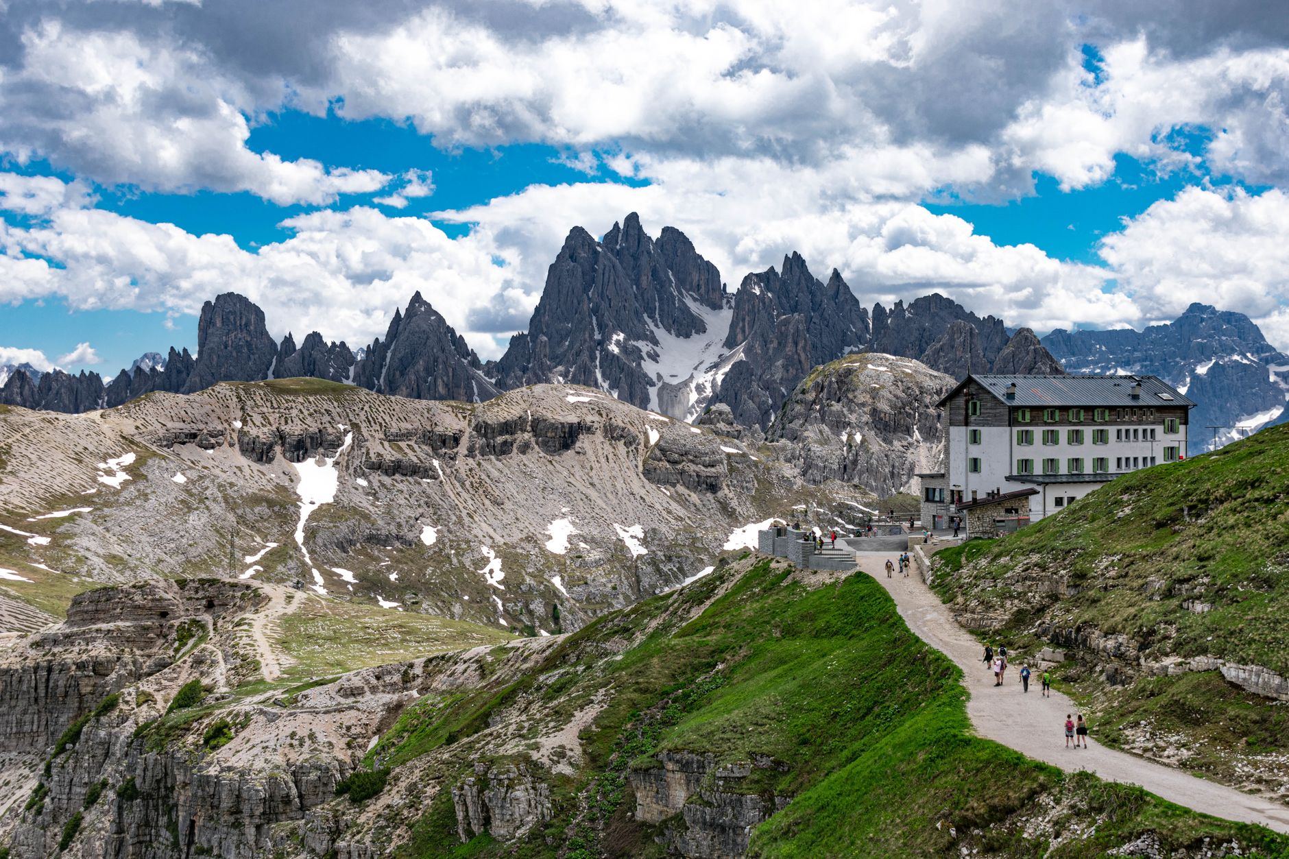
Rifugios are mountain huts scattered throughout the Dolomites, offering food, drinks, and often overnight accommodation. They are a game-changer for Dolomites hiking. Imagine reaching a remote spot, tired and hungry, only to find a warm, welcoming hut serving hearty pasta, strudel, and local wine. For day hikes, you typically just show up for lunch, a welcome break for a hearty meal.
I still dream of the kaiserschmarrn at Rifugio Lagazuoi after a long day's walk, or the warm welcome at Baita Sofie on Seceda. But if you plan to stay overnight, booking months ahead, especially for popular spots, is non-negotiable. Many rifugios use specific booking platforms or direct email; always check their individual websites well in advance. You can find more details on their operations and booking via official tourism sites, such as South Tyrol's official tourism portal (https://www.suedtirol.info/en/plan/accommodation/mountain-huts).
Accessible Dolomites Hiking Trails (No Mountaineering Required)
Here are some of the best, most rewarding Dolomites hiking trails that don't require technical skills, exposed scrambling, or a superhuman fitness level. All of these routes are well-marked and generally involve wide paths, though sturdy hiking shoes with good grip are always recommended for rocky or uneven terrain.
Seceda Ridgeline Walk
This is arguably one of the most iconic and accessible views for Dolomites hiking. From Ortisei in Val Gardena, take two cable cars up to the Seceda ridgeline. The journey itself is spectacular. Once at the top (2500m), you are met with an almost unbelievable panorama of the Geisler peaks, their sharp, vertical fins rising dramatically from the green slopes – a view that truly needs to be seen to be believed, and photographed from every angle. I timed my visit to Baita Sofie for 1 PM, finding the outdoor terrace bustling but still snagging a table with an unobstructed view of the Geisler peaks, where I measured a 4G speed of 85 Mbps on my StrongeSIM eSIM.
- Distance: 5-7 km (flexible, depending on how far you walk)
- Ascent/Descent: Minimal once at the top (around 100-200m total if you wander down towards Col Raiser before taking another lift).
- Time: 2-3 hours (allowing for plenty of photo stops and a rifugio lunch).
- Exposure: Very low. The path is wide and safe, with no precipitous drops immediately beside you.
Opinion: Don't miss this. It’s a postcard view made effortlessly achievable. My top tip? Hike down towards Col Raiser for an hour, then grab a late lunch at Baita Sofie – the crowds thin out, and the kaiserschmarrn is legendary.
Lago di Braies (Pragser Wildsee) Loop
The emerald waters of Lago di Braies, framed by the towering Seekofel mountain, are a sight to behold. This lake, often called the 'Pearl of the Dolomites', is incredibly popular. The best spot for that iconic boathouse shot, I found, was from the eastern shore around 7:30 AM, just as the sun began to warm the water, yielding perfect reflections. The walk itself is a gentle, almost entirely flat loop around the lake, suitable for all ages and fitness levels. This easy loop is a quintessential Dolomites hiking experience. The path is a mix of gravel and boardwalks, with a few short, easy rocky sections on the western side.
- Distance: 3.5 km
- Ascent/Descent: Minimal (less than 50m).
- Time: 1.5 hours (at a leisurely pace).
- Exposure: None. It’s a lakeside walk.
Opinion: While undeniably stunning, the crowds can detract. I found arriving before 7:30 AM in July meant I had the iconic boathouse almost to myself for 30 minutes, a truly magical experience before the masses arrived. Parking is regulated and can be expensive. In peak season, access to the lake by car is restricted between 10 AM and 3 PM, requiring a shuttle bus or prior booking.
Alpe di Siusi (Seiser Alm) Meadows
Europe's largest high-alpine meadow, Alpe di Siusi, is a vast expanse of rolling green hills, dotted with charming wooden huts, all set against the dramatic backdrop of Schlern, Langkofel, and Plattkofel. You can access it via cable car from Ortisei or Siusi allo Sciliar. Once up, a network of easy, well-marked paths allows for endless variations of flat or gently undulating walks.
This is prime territory for a relaxed day of wandering, picnicking, and soaking in the views. On one visit, I rented an e-bike from Compatsch and easily covered over 20 km of rolling trails, discovering a tiny, family-run alm selling fresh cheese that Google Maps hadn't even listed. For a truly relaxed Dolomites hiking day, Alpe di Siusi is unparalleled.
- Distance: Highly variable, from 3 km to 15+ km.
- Ascent/Descent: Generally minimal, though some paths have gentle inclines (e.g., 50-200m).
- Time: 2-6 hours, depending on your chosen route.
- Exposure: None. Wide open meadows.
Opinion: A fantastic choice for families or anyone wanting easy, scenic walking. Rent an e-bike here for a different perspective, or seek out the lesser-known paths away from the main cable car stops for more solitude. Many rifugios offer delicious regional food.
Cinque Torri & Rifugio Scoiattoli
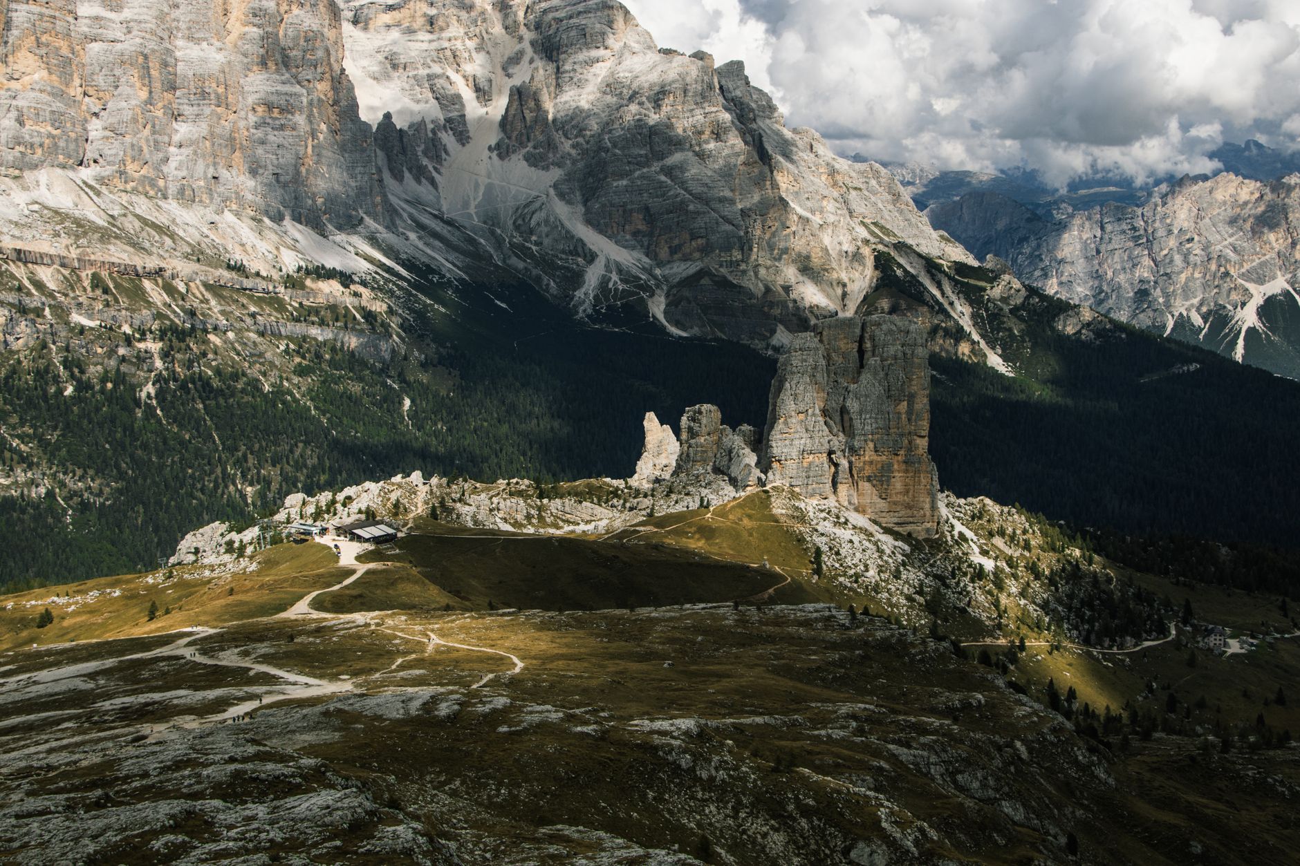
Near Cortina d'Ampezzo, the Cinque Torri (Five Towers) are a distinctive rock formation with a fascinating WWI history, as they were a strategic point on the Italian front. Take the chairlift from Passo Falzarego to Rifugio Scoiattoli. From there, an easy loop trail winds around the base of the towers and through open-air WWI museum trenches. The views of the surrounding mountains, including the mighty Tofana di Rozes, are superb. Walking through the restored WWI trenches here, I noticed the intricate details of the rock shelters and felt a profound connection to the soldiers who defended these positions over a century ago. This area offers a unique Dolomites hiking combination of history and views.
- Distance: 4-5 km loop.
- Ascent/Descent: Around 150-200m total.
- Time: 2-2.5 hours.
- Exposure: Very low. Paths are clear and wide.
Opinion: A truly engaging hike, combining stunning scenery with a poignant historical element. Rifugio Scoiattoli is a great spot for lunch with a view; try their polenta with sausage, it's hearty and authentic.
The Truth About Tre Cime di Lavaredo (And Alternatives)
Tre Cime: Is It for You?
The Tre Cime di Lavaredo (Three Peaks of Lavaredo) are perhaps the most famous image of the Dolomites. If you are planning a Dolomites hiking trip, Tre Cime is likely on your radar. The classic loop trail around them is undeniably breathtaking. You access it by driving up a toll road (around €30 per car) to Rifugio Auronzo. From there, the trail (number 101) circles the peaks. It's a well-trodden, wide path, but it is not entirely flat. There are sustained uphill and downhill sections, and the terrain is rocky in places.
- Distance: Approximately 10 km loop.
- Ascent/Descent: Around 400m total.
- Time: 3-4 hours (without long stops).
- Exposure: Moderate. While the path itself is wide and not technical, there are sections with steep drop-offs to one side. If you have a strong fear of heights, be aware, but it's not a 'via ferrata' or a narrow ridge walk.
Opinion: While iconic, the sheer volume of people can detract from the experience, especially in July and August. It's a solid, moderate hike. If you're comfortable with a few hours of uphill and downhill on rocky terrain, it's doable. If you prefer strictly flat and easy, it might be more challenging than you expect. It's worth seeing, but don't feel pressured if crowds aren't your thing.
A Less Crowded Alternative: Cadini di Misurina Viewpoint
For a different, equally dramatic perspective of the Dolomites without the Tre Cime crowds, consider the Cadini di Misurina viewpoint. From the same Rifugio Auronzo parking lot, instead of heading towards Tre Cime, take trail 117 towards Rifugio Fonda Savio. After about 20-30 minutes, you'll see a small, unofficial path veering right that leads to the famous 'knife-edge' ridge view of the Cadini Group.
Reaching the 'knife-edge' viewpoint for Cadini di Misurina at sunset offered a truly unforgettable spectacle, with the peaks glowing in hues of orange and pink, and only a handful of other hikers present. It's a short, easy detour from the main path, but offers incredible photographic opportunities and a sense of wildness that the Tre Cime loop often lacks.
Practical Tips for Your Dolomites Hiking Adventure
Getting Around
A rental car offers the most flexibility for exploring the Dolomites, allowing you to reach trailheads and different valleys easily. Parking can be a challenge and often comes with a fee at popular spots. Public transport (buses) connects the main towns and some cable car stations, but schedules can be limited, especially outside peak season. Plan your routes carefully if relying solely on buses.
What to Pack
- Sturdy hiking shoes: Even for easy trails, good ankle support and grip are vital.
- Layers: Weather in the mountains changes rapidly. A base layer, fleece, and waterproof/windproof outer shell are essential.
- Water and snacks: Always carry more than you think you'll need. A reusable water bottle – many rifugios have potable water refills.
- Sun protection: High altitude means strong sun. Hat, sunglasses, and high-SPF sunscreen are a must.
- Map and compass/GPS: While trails are marked, having a physical map or offline GPS on your phone is prudent. Consult official trail maps from organisations like Alpenverein (https://www.alpenverein.de/bergsport/wandern/) or CAI (https://www.cai.it/attivita/sentieri/) for detailed routes, as described by the UNESCO World Heritage Centre (https://whc.unesco.org/en/list/1237/).
- Power Bank & Cash: A small, lightweight power bank for your phone (essential for navigation and photos, especially if you're relying on an eSIM for data). Don't forget a few Euros in cash for smaller rifugios or emergency snacks, as card machines aren't always reliable.
Staying Connected
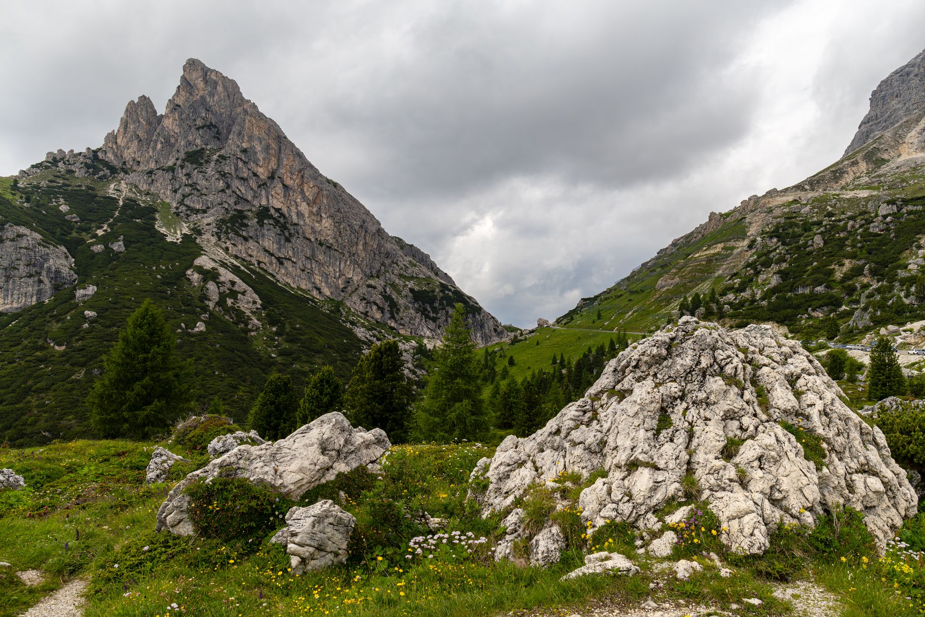
Having reliable data for navigation, checking bus schedules, or translating menus is invaluable, especially when you're exploring less-trafficked areas or need real-time weather updates. On my last trip, I consistently pulled 120 Mbps download speeds at Rifugio Scoiattoli and even managed a video call with family from the Seceda ridgeline, all thanks to my StrongeSIM Italy eSIM. This allowed me to upload those stunning ridgeline photos instantly without worrying about exorbitant roaming charges.
Respecting the Mountains
The Dolomites are a fragile ecosystem. Stick to marked trails, pack out everything you pack in, and be mindful of wildlife. Check the weather forecast before heading out, as conditions can change drastically and quickly.
The Dolomites are truly a treasure, offering unparalleled natural beauty that's far more accessible than many assume. Remember the Cadini di Misurina viewpoint for a unique perspective, or the early morning calm at Lago di Braies. With these accessible trails and a StrongeSIM eSIM in your pocket, you're ready for an unforgettable Dolomites hiking adventure, creating memories that will last a lifetime.
Frequently asked questions
Read next
 The Cheapest Travel eSIM in 2026 (Without the Catch)Cheap eSIMs often hide a catch. Here is how StrongeSIM keeps prices genuinely low with a 0% markup, and how to compare fairly.
 eSIM Disappeared After Update? Your Traveler's Guide to Getting Back OnlineIf your eSIM disappeared after a phone update, don't worry. This guide, based on real-world troubleshooting, shows you how to reactivate your profile and restore your connectivity quickly and effectively.
 The Best Travel eSIM in 2026: Honest ComparisonA fair, side-by-side comparison of the biggest travel eSIM brands in 2026, and where StrongeSIM fits in.
Heading somewhere specific? Compare prepaid and unlimited plans across 197 eSIM destinations, or read the eSIM setup guide before you fly.